
Date & time: 2023-08-30 02:17:10 (UTC)
Local time at epicenter: Wednesday, Aug 30, 2023 at 9:17 am
Latitude/ Longitude: 6°02'24.0"S 103°52'12.0"E
Epicenter: Indian Ocean
Magnitude: 5.0
Depth: 10.0 km

Waveform
Listen to the waveform as audio:
ShakeMap
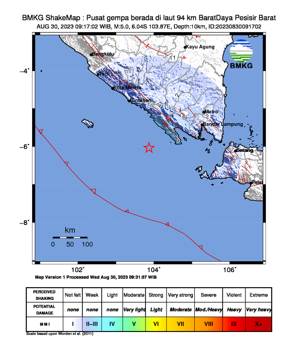
Nearby towns/cities
- 141.5 km (87.9 mi) WSW of Bandar Lampung, Lampung, Indonesia
- 162.9 km (101.2 mi) SSW of Kotabumi, Lampung, Indonesia
- 166.9 km (103.7 mi) SW of Metro, Lampung, Indonesia
- 178.9 km (111.1 mi) SW of Terbanggi Besar, Lampung, Indonesia
- 184.5 km (114.6 mi) W of Labuan, Banten, Indonesia
MMI (Modified Mercalli Intensity) Scale:
- II Liwa
Find us on
- Instagram: earth4444_
- Tiktok: @earth.44_
- Telegram: earthquake44
- Youtube: @earth44