
Date & time: 2023-08-29 04:34:44 (UTC)
Local time at epicenter: Tuesday, Aug 29, 2023 at 1:34 pm
Latitude/ Longitude: 5°32'24.0"S 130°02'24.0"E
Epicenter: Banda Sea
Magnitude: 6.4
Depth: 209.0 km

Waveform
Listen to the waveform as audio:
ShakeMap
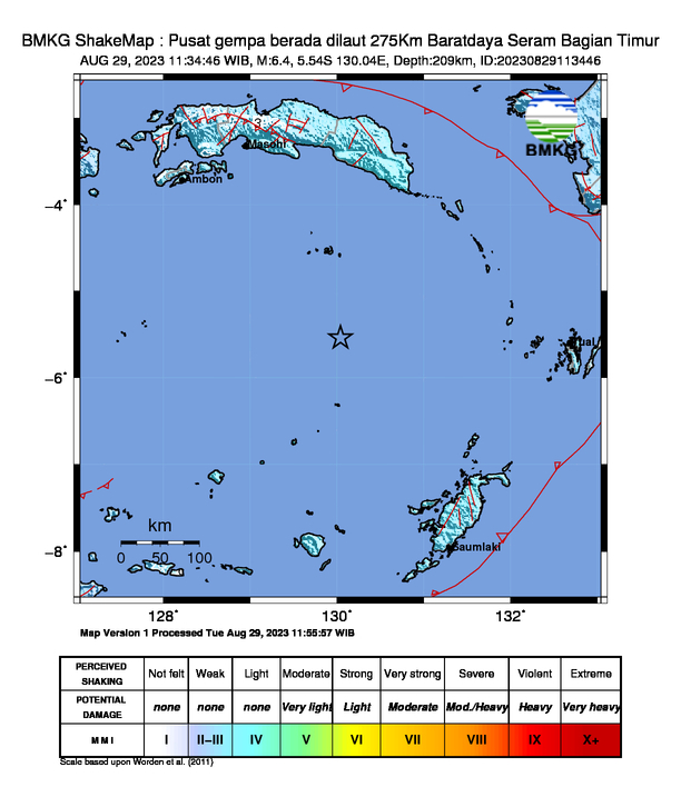
Nearby towns/cities
- 272.5 km (169.3 mi) SSE of Amahai, Maluku, Indonesia
- 274.4 km (170.5 mi) SSE of Masohi, Maluku, Indonesia
- 286.9 km (178.3 mi) SE of Ambon, Maluku, Indonesia
- 306.8 km (190.6 mi) W of Tual, Maluku, Indonesia
- 388.7 km (241.5 mi) SW of Fakfak, Papua, Indonesia
MMI (Modified Mercalli Intensity) Scale:
- II-III Banda
- II-III Saumlaki
Find us on
- Instagram: earth4444_
- Tiktok: @earth.44_
- Telegram: earthquake44
- Youtube: @earth44
Dari Mana gempa berasal min?
ReplyDelete