
Date & time: 2023-09-19 12:16:33 (UTC)
Local time at epicenter: Tuesday, Sep 19, 2023 at 7:16 pm
Latitude/ Longitude: 5.341°S 103.672°E
Epicenter: Indian Ocean
Magnitude: 4.9
Depth: 59.9 km

Waveform
Listen to the waveform as audio:
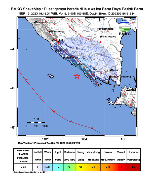
ShakeMap
Nearby towns/cities
- 145.7 km (90.5 mi) SSW of Baturaja, South Sumatra, Indonesia
- 145.9 km (90.7 mi) WSW of Kotabumi, Lampung, Indonesia
- 153.9 km (95.6 mi) SSE of Pagar Alam, South Sumatra, Indonesia
- 156.9 km (97.5 mi) S of Tanjungagung, South Sumatra, Indonesia
- 176.4 km (109.6 mi) W of Bandar Lampung, Lampung, Indonesia
MMI (Modified Mercalli Intensity) Scale:
- III-IV Liwa
- III-IV Krui
- II Semaka
- II Sekincau
Find us on
- Instagram: earth4444_
- Tiktok: @earth.44_
- Telegram: earthquake44
- Youtube: @earth44