
Date & time: 2023-09-22 14:59:17 (UTC)
Local time at epicenter: Friday, Sep 22, 2023 at 11:59 pm
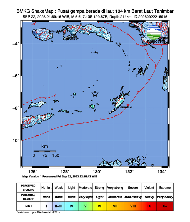
Latitude/ Longitude: 7°07'48.0"S 129°52'12.0"E
Epicenter: Banda Sea
Magnitude: 6.6
Depth: 214.0 km

Waveform
Listen to the waveform as audio:
ShakeMap
Nearby towns/cities
- 336.6 km (209.1 mi) ENE of Lospalos, Lautém, Timor Leste
- 375.8 km (233.5 mi) WSW of Tual, Maluku, Indonesia
- 388.7 km (241.5 mi) ENE of Baukau, Baucau, Timor Leste
- 403.9 km (251 mi) ENE of Venilale, Baucau, Timor Leste
- 419.1 km (260.4 mi) SSE of Ambon, Maluku, Indonesia
MMI (Modified Mercalli Intensity) Scale:
- III-IV Saumlaki
- III Maluku Tenggara
- III Marsela
- III Sorong
- II Tepa
Find us on
- Instagram: earth4444_
- Tiktok: @earth.44_
- Telegram: earthquake44
- Youtube: @earth44