
Date & time: 2023-10-29 00:56:06 (UTC)
Local time at epicenter: Sunday, Oct 29, 2023 at 7:56 am
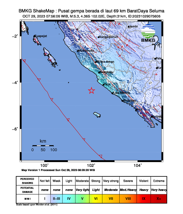
Latitude/ Longitude: 4°21'36.0"S 102°01'12.0"E
Epicenter: Indian Ocean
Magnitude: 5.3
Depth: 31.0 km

Waveform
Listen to the waveform as audio:
ShakeMap
Nearby towns/cities
- 56.6 km (35.2 mi) SSW of Bengkulu, Bengkulu, Indonesia
- 101.9 km (63.3 mi) SSW of Curup, Bengkulu, Indonesia
- 131.9 km (81.9 mi) WSW of Pagar Alam, South Sumatra, Indonesia
- 139.1 km (86.4 mi) SW of Lubuklinggau, South Sumatra, Indonesia
- 170.7 km (106.1 mi) WSW of Lahat, South Sumatra, Indonesia
MMI (Modified Mercalli Intensity) Scale:
- III Bengkulu
- II Kepahiang
Find us on
- Instagram: earth4444_
- Tiktok: @earth.44_
- Telegram: earthquake44
- Youtube: @earth44