
Date & time: 2023-11-01 14:07:48 (UTC)
Local time at epicenter: Wednesday, Nov 1, 2023 at 10:07 pm
Latitude/ Longitude: 8.333°S 121.545°E
Epicenter: Flores Sea
Magnitude: 5.1
Depth: 13.2 km

Waveform
Listen to the waveform as audio:
ShakeMap
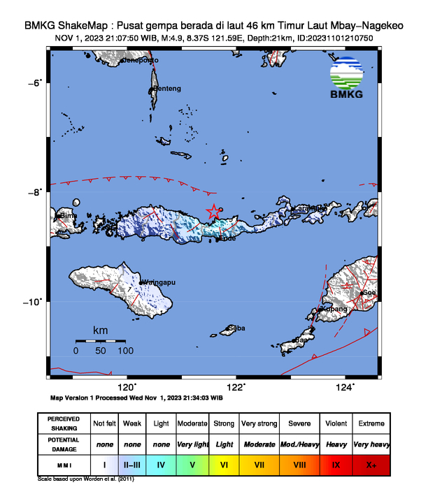
Nearby towns/cities
- 58.2 km (36.2 mi) NNW of Ende, East Nusa Tenggara, Indonesia
- 80 km (49.7 mi) WNW of Maumere, East Nusa Tenggara, Indonesia
- 122.9 km (76.4 mi) ENE of Ruteng, East Nusa Tenggara, Indonesia
- 183.4 km (113.9 mi) E of Labuan Bajo, East Nusa Tenggara, Indonesia
- 305.2 km (189.6 mi) NW of Kupang, East Nusa Tenggara, Indonesia
MMI (Modified Mercalli Intensity) Scale:
- III-IV Maumere
- III-IV Ende
Find us on
- Instagram: earth4444_
- Tiktok: @earth.44_
- Telegram: earthquake44
- Youtube: @earth44