
Date & time: 2024-01-25 14:41:28 (UTC)
Local time at epicenter: Thursday, Jan 25, 2024, at 10:41 pm
Latitude/ Longitude: 8.699°S 115.644°E
Epicenter: Bali Sea
Magnitude: 4.8
Depth: 124.1 km

Waveform
Listen to the waveform as audio:
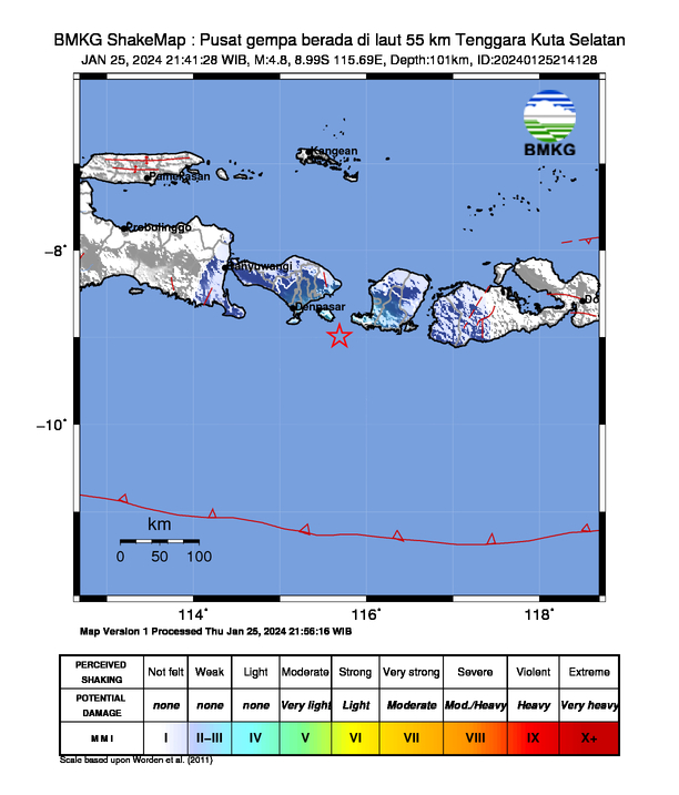
ShakeMap
Nearby towns/cities
- 27.8 km (17.3 mi) S of Amlapura, Bali, Indonesia
- 28.1 km (17.5 mi) S of Amlapura city, Bali, Indonesia
- 28.2 km (17.5 mi) SSE of Bedugul, Bali, Indonesia
- 32.6 km (20.2 mi) SE of Klungkung, Bali, Indonesia
- 47.3 km (29.4 mi) E of Denpasar, Bali, Indonesia
Find us on
- Instagram: earth4444_
- Tiktok: @earth.44_
- Telegram: earthquake44
- Youtube: @earth44