
Date & time: 2024-01-07 10:38:21 (UTC)
Local time at epicenter: Sunday, Jan 7, 2024 06:38 pm
Latitude/ Longitude: 1.840°S 122.531°E
Epicenter: Banda Sea
Magnitude: 4.9
Depth: 10.0 km

Waveform
Listen to the waveform as audio:
ShakeMap
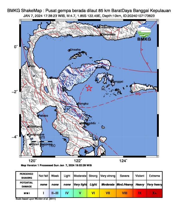
Nearby towns/cities
- 103 km (64 mi) SSW of Luwuk, Central Sulawesi, Indonesia
- 203.9 km (126.7 mi) ESE of Poso, Central Sulawesi, Indonesia
- 237.9 km (147.8 mi) N of Kendari, Southeast Sulawesi, Indonesia
- 257.5 km (160 mi) ENE of Masamba, South Sulawesi, Indonesia
- 271.2 km (168.5 mi) SSW of Gorontalo, Gorontalo, Indonesia
MMI (Modified Mercalli Intensity) Scale:
- III Luwuk
- III Morowali
- II - III Bungku
Find us on
- Instagram: earth4444_
- Tiktok: @earth.44_
- Telegram: earthquake44
- Youtube: @earth44